Our original plan for Friday was to hike some of the trails in Cultus Lake Provincial Park. But that plan was canceled because of the closure of the trails. Click here to see the article. Here is the headline:

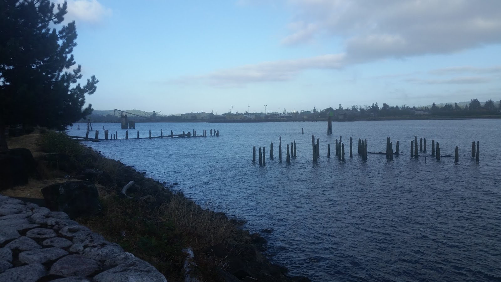
This is looking east, up stream on the Chehalis River.

This was looking west at the railroad bridge over the Wishkah River. It has a round turnstile on the west side so that when the bridge turns, the full width of the river is open to boat traffic.

Just north and upstream from the railroad bridge was one of two bridges for car traffic across the Wishkah River. The paved trail and our hotel were on the right.

Here was another view of the railroad bridge, looking back downstream from our hotel.


And this was the drawbridge over the Wishkah River for car traffic going east - unlike the railroad bridge where the turnstile was on the side of the river, this had the turnstile in the middle of the river.

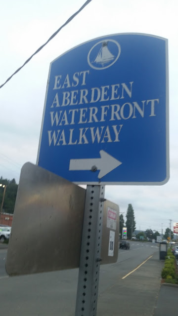
I learned a bit about the 1.6 mile East Aberdeen Waterfront Walkway and saw the mileage markers, as well as the list of contributors to the walkway - Walmart was one of them.


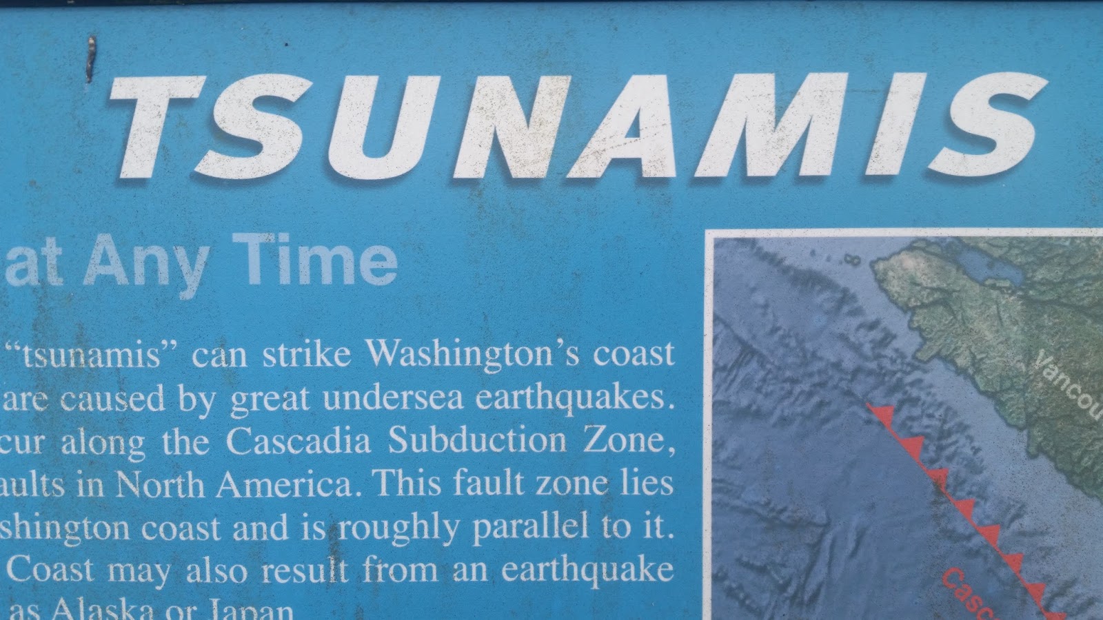
There was lots of good info about tsunamis.


Extreme weather forces closure of Cultus Lake trails
So we decided to give up Hope and spent the day driving south and west to Aberdeen, WA. While there was reported to be some remnants of the smoke from British Columbia, the high temps ended Thursday evening. So it was quite pleasant to arrive and not need the air conditioner blasting at full strength - instead we could have the window open and the natural breeze was delightful.
The hotel I chose is at the junction of the Wishkah and Chehalis Rivers - the view from our window is the Wishkah River. We decided to go to the nearby Walmart supercenter to buy salads for dinner - there is a paved trail behind our hotel which takes us less than two minutes to go under and get to the other side of the railroad tracks to reach Walmart.
This was looking somewhat southeast across the Chehalis River at the drawbridge on US Highway 101 that runs along the coast from Canada to Mexico.

This is looking east, up stream on the Chehalis River.
This was looking west at the railroad bridge over the Wishkah River. It has a round turnstile on the west side so that when the bridge turns, the full width of the river is open to boat traffic.


Here was another view of the railroad bridge, looking back downstream from our hotel.

As is my routine, early Saturday morning I went back out. This was the drawbridge over the Wishkah river for car traffic going west.


And this was the drawbridge over the Wishkah River for car traffic going east - unlike the railroad bridge where the turnstile was on the side of the river, this had the turnstile in the middle of the river.

I learned a bit about the 1.6 mile East Aberdeen Waterfront Walkway and saw the mileage markers, as well as the list of contributors to the walkway - Walmart was one of them.


There was lots of good info about tsunamis.


The walkway ends in a park with the Rotary Log Building and is near the site where a sawmill once stood.


No comments:
Post a Comment