Wednesday, May 24, 2017

Ruidoso NM Part Two, May 21 - 23, 2017

On Saturday, my left foot was bothering me, so we did not go hiking again.  Instead, we visited the Lincoln State Monument.  Lincoln has become a historical district and there are 8 or 9 museums plus several other buildings that have been (or are being) restored.  We started with visiting the largest museum and watched a video about Lincoln's history, including the Lincoln County War and Billy the Kid.  One of the interesting items in that museum was an old stage coach.


We then walked through several other buildings and museums that were open, including Dr. Woods' house - although the building dates from the 1860s, Dr. Woods and his wife lived here in the 1900s.


This area became the New Mexico territory after the Mexican American War of 1846 - 1848.  Prior to that, it had been the home of the Mescalero Apache and the Hohokams to the 1500s, then Spanish territory until the War of Mexican Independence in 1819, then Mexican territory until 1848.  That means there were a lot of Spanish/Mexican people living here, as well as Anglos who came later.  The town was called Placita del Rio Bonito before becoming Lincoln (named after our President Lincoln).


We then had lunch in the Lincoln Park before visiting the last museum, one of the stores.


Then we drove to Capitan and along the way stopped at a road side memorial to the Capitan fire of 1950.


The Smokey Bear Historical Park is nicely landscaped with xeriscape gardens in front.


Inside, we watched a movie about how Smokey the Bear was created during WWII to protect our forests because they were seen as a critical war material resource.  At that time, wood was still used in constructing air planes.  After the Capitan fire of 1950, a small bear cub was found injured and stuck in a tree - he was rescued and brought back to health and then moved to the National Zoo in Washington DC for the rest of his 26 years of life.  When he died in 1976, he was brought back to Capitan and buried in the park.


Then we headed back to our rental house (the Nutt House) in Ruidoso for a quiet evening with lasagna, salad and wine for dinner.  Monday, we took it easy and watched a couple of movies.  And Tuesday, we made the trip back by the southerly route - easily done in about nine hours.  Among other things, we passed both White Sands National Monument and White Sands Missile Range - apparently, signs indicated that the road is closed at times, we think because of possible missile tests by the US Army which controls the range.  We also passed the spot where the first nuclear bomb test was held - it is only twice per year for visits.

Sunday, May 21, 2017

Ruidoso, NM, Part One May 18 - 20

In an effort to escape the heat, we decided to explore Ruidoso over a long weekend.  It is an eight hour drive from Phoenix and we came across some interesting things along the way.  Perhaps the most interesting was the Very Large Array.  My photo does not do justice to it.


This photo from the website is better.


This description is from the website:   "The Very Large Array, one of the world's premier astronomical radio observatories, consists of 27 radio antennas in a Y-shaped configuration on the Plains of San Agustin fifty miles west of Socorro, New Mexico. Each antenna is 25 meters (82 feet) in diameter. The data from the antennas is combined electronically to give the resolution of an antenna 36km (22 miles) across, with the sensitivity of a dish 130 meters (422 feet) in diameter."

I had never heard of the National Radio Astronomy Observatory, but through the wonder of internet access from our cellphones, we also learned about the Very Long Baseline Array: "The Very Long Baseline Array (VLBA) is an interferometer consisting of 10 identical antennas on transcontinental baselines up to 8000 km (Mauna Kea, Hawaii to St. Croix, Virgin Islands). The VLBA is controlled remotely from the Science Operations Center in Socorro, New Mexico. Each VLBA station consists of a 25 m antenna and an adjacent control building. The received signals are amplified, digitized, and recorded on fast, high capacity recorders. The recorded data are sent from the individual VLBA stations to the correlator in Socorro."
We also saw a sign for "TERA Site."  What could that be?  "The Terminal Effects Research and Analysis Group (TERA) became the first research center at the New Mexico School of Mines in 1946. TERA and its founder EJ Workman played a significant role in the development and deployment of the proximity fuse during World War II. This work flourished after the war as TERA continued to develop fusing devices and expanded into warhead design and testing. Due to the success of this endeavor, EJ Workman was made the President of the University and he changed its name to the New Mexico Institute of Mining and Technology. Today the Energetic Materials Research and Testing Center (EMRTC) stands in place of TERA. EMRTC's 40-square-mile field laboratory is located in the mountains adjacent to the New Mexico Tech campus in Socorro, New Mexico. The field laboratory contains more than 30 test sites, gun ranges, other research facilities and storage areas, allowing for a complete spectrum of research and testing activities. EMRTC has the ability to conduct tests involving over 20,000 pounds of explosives. Current activities include warhead development and testing, large scale building survivability, Improvised Explosive Devise (IED) defeat, analysis and evaluation of homemade explosives."

We also saw signs for the "Lincoln Monument" - we thought that was in Washington DC, honoring President Lincoln.  But here in New Mexico, it honors the "Lincoln County War of 1878."  It all happened in and around Lincoln, New Mexico, then still a territory of the US (the territory eventually became the 47th and 48th states of New Mexico and Arizona in 1912).  "The Lincoln County War was an Old West conflict between rival factions in 1878 in New Mexico Territory. The feud became famous because of the participation of Billy the Kid."  Nowadays, there are many sites named after Billy the Kid and Kit Carson.

Through VRBO, we found a rental house in Ruidoso, owned by the Nutt family and appropriately named.  The town and the street where the Nutt House is located are surrounded by Lincoln National Forest.


On Friday, I walked the one and a half miles to the local Albertson's grocery store.  On my way back, I stopped at the local forest ranger station to get recommendations on where to hike.


Our first adventure was to Fort Stanton.  "The Fort Stanton Historic Site is a must-see attraction when visiting Lincoln County.  Nestled on Highway 220 that bisects the Billy the Kid Scenic Byway, New Mexico’s newest historic site features over 155 years of southwestern history ranging from its initial creation as a military garrison to its significance as the first tuberculosis hospital in the state, to an internment camp for German seaman during World War II."  We visited the museum and then walked around the grounds.  "With 53 buildings along the Rio Bonito, Fort Stanton is an ongoing project of the New Mexico Department of Cultural Affairs, ..."  We ate lunch at the picnic tables by the museum, then set out to take a hike nearby.  "Fort Stanton is also partner with the Bureau of Land Management (BLM) which oversees thousands of acres surrounding Fort Stanton. Visitors are invited to enjoy the nearly 100 miles of trails, a camping area, and horseback riding operated by BLM."

Saturday, we went to the Cedar Creek Recreation Area of Lincoln National Forest.  We enjoyed a scenic six mile hike along the Upper Cedar Creek Trail, followed by a picnic lunch on one of the picnic tables in the heart of the recreation area.


Saturday evening was a quiet night back at the Nutt House, enjoying lasagna and salad, and just taking it easy.

Thursday, May 18, 2017

Hassayampa River Preserve, Wednesday, May 17, 2017

On Wednesday, we drove northwest to Hassayampa River Preserve, just outside of Wickenburg.  It is owned and operated by the Arizona chapter of the Nature Conservancy - it is one of six they have in Arizona.  "Hassa" means upside down and "yampa" means river.  This river has a large watershed draining the mountains south of Prescott - but most of it runs underground, some 90+ miles, with only about six miles above ground here.  This creates a beautiful oasis of green in the middle of the desert.

We began at the Visitor Center which had a bunch of hummingbirds buzzing about the garden and feeders.


We spent about 30 minutes learning about the 280 species of birds in the park, as well as other fauna and flora.  We also learned more about the Nature Conservancy and their mission.


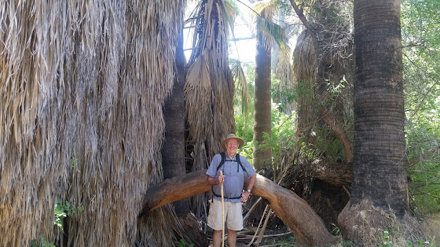
There were some amazingly huge palm trees - unlike in urban Phoenix, the dead leaves from prior years are not trimmed off so they make a cover of leaves making the base of the tree look like it is seven or eight feet in diameter.


They had benches throughout the preserve so that you can sit quietly and view what is happening around you in this beautiful riparian area.


Except for the climb up to Lyte's Lookout, the trails are all easy to explore, mostly flat and rarely narrow.


There is a lake in the middle of the preserve, and a lot of good information about the importance of protecting this area from what can happen if too much water is sent out of the watershed to provide for people who choose to live in the desert in Phoenix-Tucson metro area.


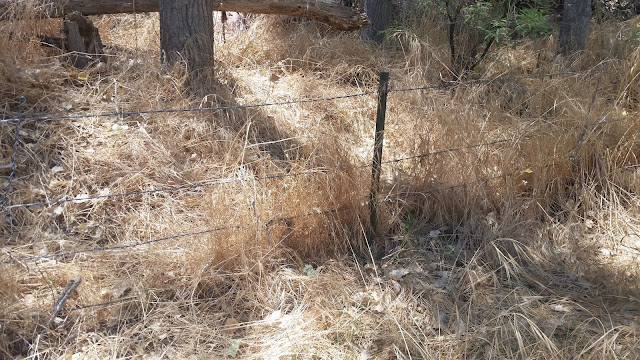
We also learned about barbed wire and how to use it in a way that protects wildlife yet keeps cattle and other livestock where the rancher wants them.


We came across several varieties of lizards.


These trails were all among the trees except for the one that climbs up to Lyte's Lookout.


The trail rises quickly and you can easily see the difference between desert and the green riparian area here on the Hassayampa River.


Once at the lookout, they have large panoramic signs identifying the mountains you can see in the distance.


It is amazing how this small amount of water in this small river (really only a large stream) can create such a lush green environment.


We stopped back at the Visitors Center and confirmed that one of the animals we had seen was a gray fox.  We also learned more about the other preserves in Arizona and plan to visit them in the future.