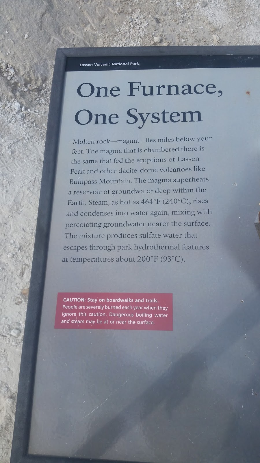
We both wanted to avoid traveling on I-5 in California when driving from Portland to Phoenix. Our first day this past Sunday, we were on I-5 for four hours en route to White City, OR. From White City, we were able to visit Crater Lake National Park and Lava Beds National Monument, and on the back roads from White City, we were able to visit Lassen Volcano National Park ending up in Chester, CA. Chester is a small city that honors their residents who are in the military by having these large signs on light poles.


Besides noticing the military recognition on my early morning walk around town, I also discovered "Dinky." Chester is on Lake Almanor, and Butt Lake is nearby. Both are man made lakes and "Dinky" was one of the narrow gauge engines used to haul dirt and rock for the dams in 1910 - 1914. After building the dams, "Dinky" was left behind and not discovered until they drained Butt Lake to repair the dam. The engine was then cleaned up and is now on display in the center of town.


From Chester, our route took us through several small towns and into Reno, NV, where we planned to have a picnic lunch. We tried Hunter Creek Park - it had picnic tables, parking and great views down onto Reno but had no shade. We then tried Ambrose Park - it had parking, many shade trees but no picnic tables. Next was Betsy Caughlin Donnelly Park - a beautiful park, many shade trees, picnic tables but no parking. Finally, we went to Crissie Caughlin Park which had all the required elements. It is connected to the Reno bike path that parallels the Truckee River.


From Reno we continued south to Bridgeport. The town is known for fishing, and our hotel even has rooms that open out to the river for those who want to fish.

Bridgeport is in the eastern Sierras and is at 6,485 feet elevation. While a small town, it still has an interesting history. The Bridgeport Inn has picnic tables from old tree stumps and a wagon made into a flower garden. It has a Mark Twain room, as Samuel Clemens supposedly stayed there.


The mountains around the town still have snow on them.


The logging and gold mining history of the area is on display in the park.

A grand old courthouse is still the center of town.


And here is the side of our hotel that opens out on to the river.

Sometimes it is good to take the road less traveled.