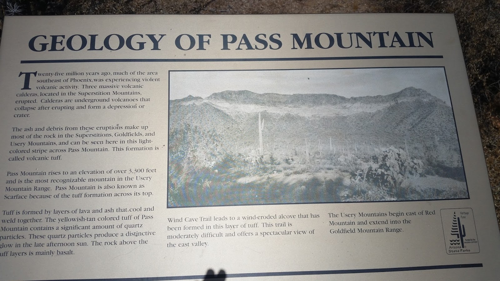
On Monday, we decided to hike the Wind Cave Trail. The trail goes up over 800 feet in elevation as it climbs the side of Pass Mountain. We learned that the light colored horizontal stripe across the mountain is tuff, the ashy residue of volcanic eruptions. Not only is it lighter in color than the basalt levels above and below it, it is also softer. This means that the wind and rain can erode the tuff more easily, so that stripe allows a C shaped cut into the side of the mountain - so it is not really a cave but rather a shelter eaten into the side of the mountain.

The Wind Cave starts in Usery Mountains Regional Park east of Mesa but after about 200 yards, crosses into Tonto National Forest. In our hiking guidebook, online and at Usery Mountains Regional Park, the trail is described as either moderate or difficult - but the warning as we entered Tonto National Forest caused us to think about this: WARNING Hazardous Trail Extremely Steep Sections USE CAUTION

We had read about the white Phoenix sign and arrow on the side of the nearby mountain, supposedly built in the 1950s to guide lost pilots to Phoenix.


The trail gains elevation at a moderate pace in the first half, but it still provides an amazing view of the valley as we looked back west towards Mesa and metro Phoenix.


We came across this lizard and thought perhaps it was a chuckwalla because of the stripes on the tail - but I think it may have been something else.


About two thirds of the way up, we came across some of the tuff that had been worn away by the wind - and there was a lot of wind. We had to use the strings under our chins to keep our hats from being blown away.


After about an hour and a half, we reached the cave. We saw signs warning us of the danger of going further.

We sat down to have a snack in the shade of the Wind Cave, as had other hikers. If you look closely at the photo below, you can see two people in another part of the cave - they are about an inch above Patty's head at the 11 o'clock position.

Before we could even get a snack out of my backpack, we were approached by a fat ground squirrel. It is obvious that she has learned that people mean food, even up here at this remote site. I had to use my walking stick in a pool cue like manner to poke her in the nose to go away.


After our snack, I shot this video to get a panoramic view of the area.
We had noticed that the squirrel had not gone far away, and kept moving around some orange peels about eight feet from where we were seated. It was only then that we realized the squirrel was facing off with what appears to be a western diamondback rattlesnake. My guess is that she was trying to get food for her babies when she approached us, and then very diligently protecting her babies from the rattlesnake (and yes, at one point we could hear the snake's rattle).
We slowly descended the mountain, then went to the Vista Point trail, a short trail with a 200 foot elevation gain but that allowed us to look back at Pass Mountain and see the tuff from a distance, and better understand how the Wind Cave was formed.
It was a nice sunny but windy day for hiking, covering about 6.5 miles at an easy pace over four hours.
No comments:
Post a Comment