On Wednesday, Patty and I drove to Champoeg State Park. The website describes bike and hiking trails along the river and a historical Country Store. We stopped at the Butteville General Store to get lattes and a pastry - it has been open since the late 1800s.
When we parked at the visitors center, one of the first things we saw were birdhouses - they are to help the Western Bluebird that used to be common here.
Just outside the visitors center, we learned about portable burrstone mills used to mill grain grown by the local farmers.
Inside the visitors center, we learned more about the history of the state of Oregon, including the 1843 meeting and vote in Champoeg to form the first Provisional Government, which eventually led to territory status and then to becoming the 33rd state in 1859.
Champoeg Creek and surrounding land made an ideal place for farms, a town and access by river. Plans were made for a center of government - but nature intervened in the way of a massive flood that washed the entire town away in 1861. We saw these markers as we hiked west from the visitors center.
At the western end of the park, we found the riverside trail and enjoyed hiking in relative shade.
The trail ended because of a creek too big to cross, so back out on the main trail the Townsite Trail starter. There were markers showing where the actual and planned streets were located, all in a grid plan like any modern city - except that it is all fields and woods now, making for nice hiking in the shade.
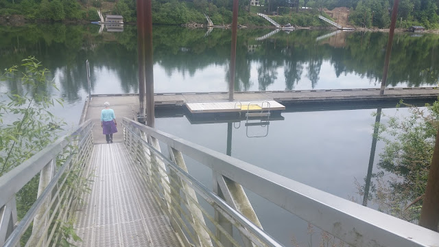
We finally came to stop 46 on the Willamete River Water Trail, an easy place to stop whether hiking like us or boating on the river.
From there, it was a couple of miles through other parts of the park, including the 18 hole disc golf course and other day use areas, and then back home to Portland.


No comments:
Post a Comment