Our original plan was to visit Crater Lake National Park - but we found out that much of it is still closed due to snow, so we went elsewhere. Since we had already visited Lava Butte, we started the day by exploring a second part of Newberry National Volcanic Monument. Paulina Lake is the caldera of the volcano that erupted some 7,000 years ago. On the 13 mile drive into Paulina Lake Visitor Center, we stopped at an overlook to see other volcanic mountains in the area and to learn about how fire affects forests (including how we have changed firefighting).


The visitor center is open weekends now but starting Saturday, will be open seven days per week for the summer season.


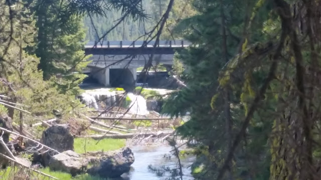
We went back 1/4 mile to the Paulina Falls and started exploring.


After checking out Paulina Falls from the top, we proceeded upstream along Paulina Creek towards the lake.


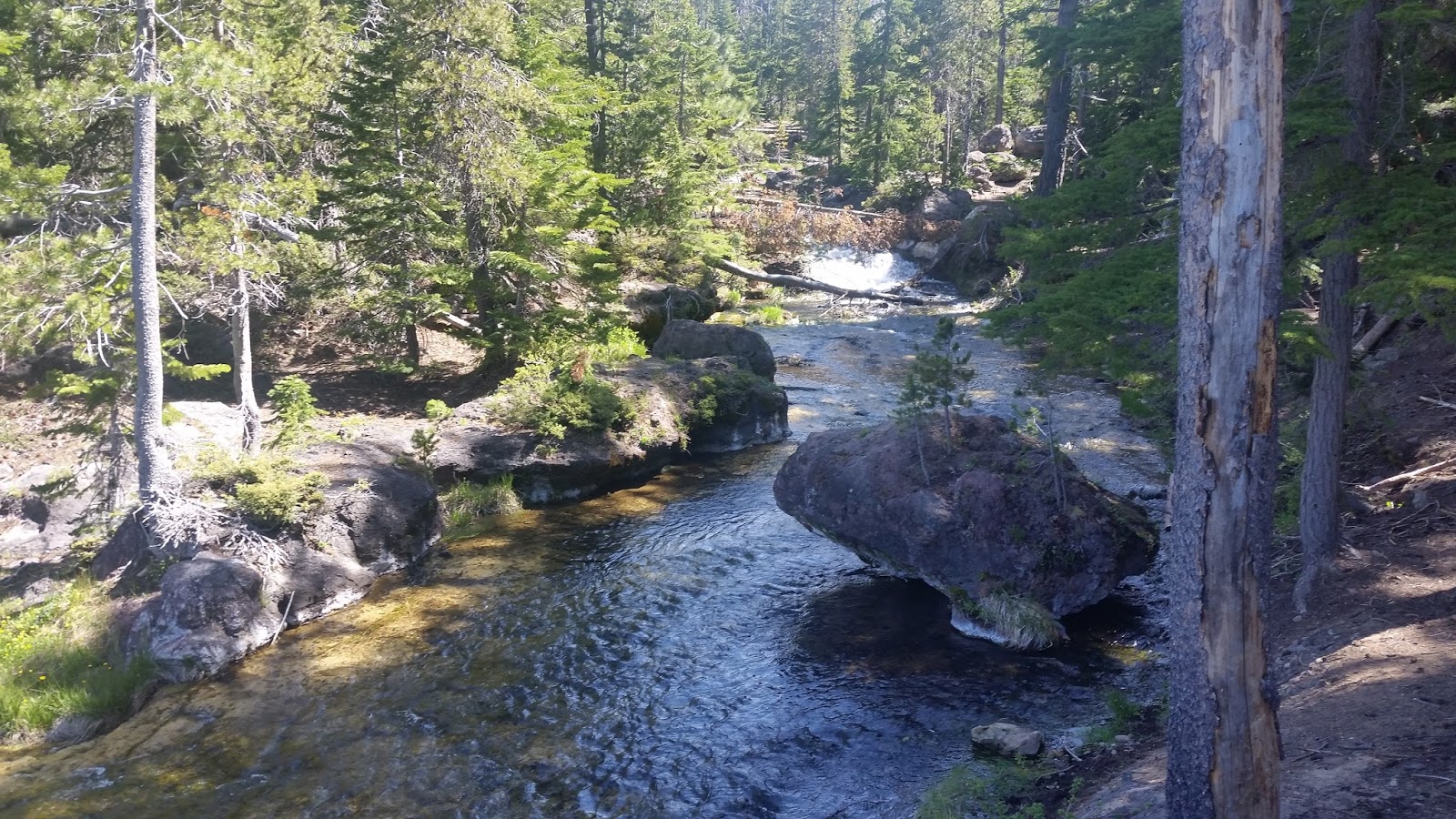
We crossed the bridge and dam and headed out towards Paulina Lake Lodge and the marina.


We turned around, went back across the bridge and set out on the eight mile loop trail that goes around Paulina Lake. Our plan was to go a couple of miles and return. Besides lots of wildlife enjoying the lake, we learned that they have found a building that goes back some 7,000 years.


The trail had lots of trees down. Some were from prior years, but some were obviously from this past winter with record snowfall.

There were many places with snow on the trail and in the woods, but that is not what stopped us. Instead, it was the high water level of the lake that put a port of the trail underwater - with the only apparent way around a rather perilous climb over rocks.

We turned around and headed back towards Paulina Falls. Along the way, we passed the boat launch areas and learned about the Deschutes Paddle Trail - I bet Ben and Martha would be interested in kayaking along the trail.


Back at Paulina Falls, the trail descends with switchbacks down the hill. We could see the falls from midpoint at one of the turns.


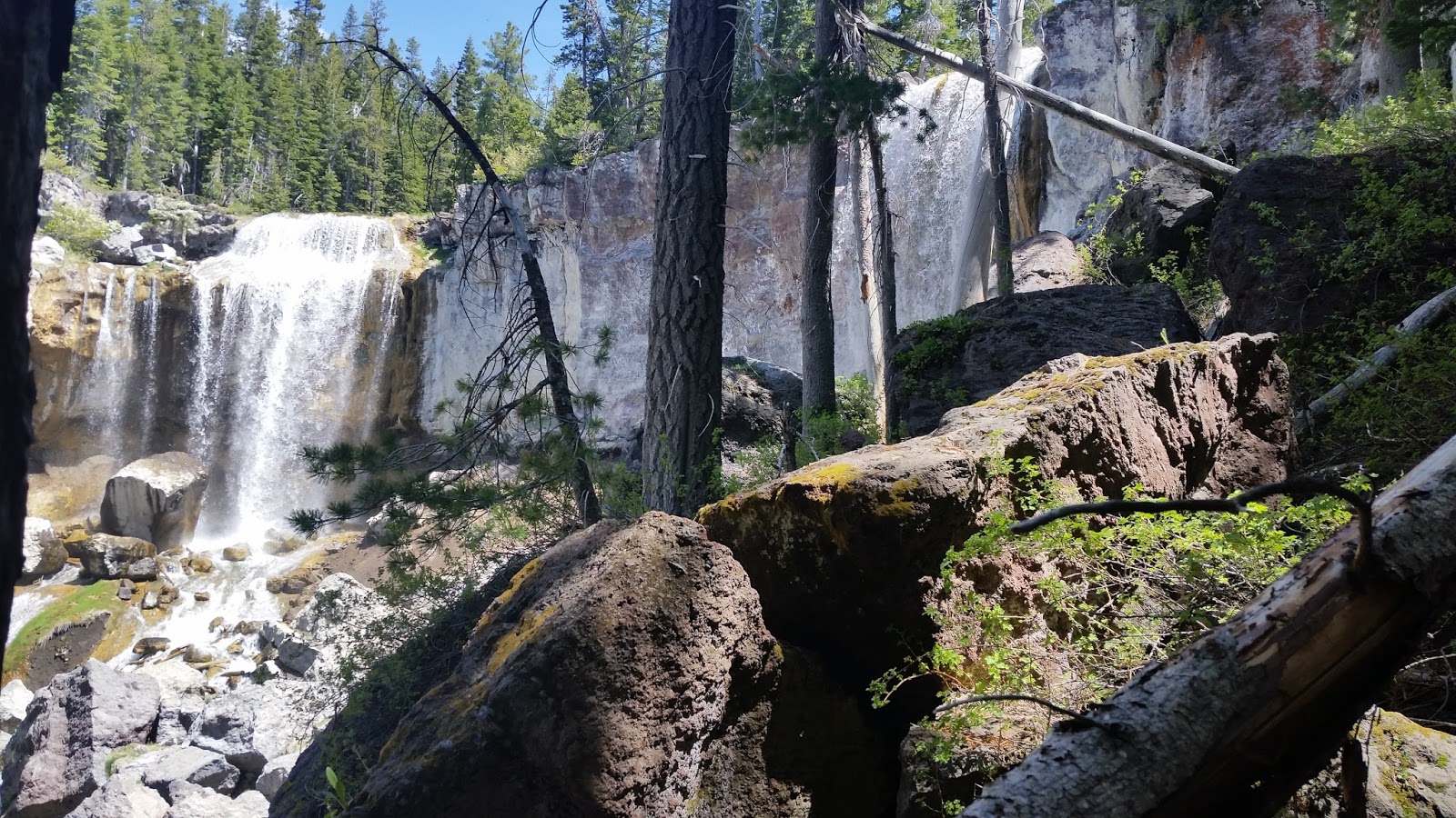
There was lots of debris, both here and at the lower viewing point, but the trail was relatively easy to walk.


At the bottom, they have built a bridge over the many boulders that have fallen from the waterfalls.


To give some perspective, many of those boulders are the size of small cars - a spectacular view.
After returning to the car, we had covered about 4.5 miles, had a drink, and then headed off to La Pine State Park.


The visitor center is open weekends now but starting Saturday, will be open seven days per week for the summer season.


We went back 1/4 mile to the Paulina Falls and started exploring.


After checking out Paulina Falls from the top, we proceeded upstream along Paulina Creek towards the lake.


We crossed the bridge and dam and headed out towards Paulina Lake Lodge and the marina.


We turned around, went back across the bridge and set out on the eight mile loop trail that goes around Paulina Lake. Our plan was to go a couple of miles and return. Besides lots of wildlife enjoying the lake, we learned that they have found a building that goes back some 7,000 years.


The trail had lots of trees down. Some were from prior years, but some were obviously from this past winter with record snowfall.

There were many places with snow on the trail and in the woods, but that is not what stopped us. Instead, it was the high water level of the lake that put a port of the trail underwater - with the only apparent way around a rather perilous climb over rocks.

We turned around and headed back towards Paulina Falls. Along the way, we passed the boat launch areas and learned about the Deschutes Paddle Trail - I bet Ben and Martha would be interested in kayaking along the trail.


Back at Paulina Falls, the trail descends with switchbacks down the hill. We could see the falls from midpoint at one of the turns.

There was lots of debris, both here and at the lower viewing point, but the trail was relatively easy to walk.


At the bottom, they have built a bridge over the many boulders that have fallen from the waterfalls.


To give some perspective, many of those boulders are the size of small cars - a spectacular view.
After returning to the car, we had covered about 4.5 miles, had a drink, and then headed off to La Pine State Park.
No comments:
Post a Comment