We decided to hike to Stony Squaw Summit, so we drove up to the Cascade Amphitheater Parking Lot at Mt. Norquay Ski Area.

As we had seen elsewhere, bear warnings are posted, so I had my bear spray out and attached to my belt for quick access. This is in contrast to many of the hikers and mountain bikers we have seen.

Online, I had read that this hike was 2.2 km (1.4 miles) each way and would take an hour to an hour and a half to complete. The sign at the base of the trail seemed to confirm that. Either we are getting old or those numbers are way off - it took us better than two hours and my pedometer said a bit over four miles.

The trail was through thick woods all the way, with many downed trees on and near the trail.


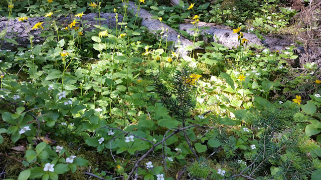
As elsewhere, many wildflowers are still in bloom.
There were many exposed tree roots, leading to jokes about the "root of all evil."

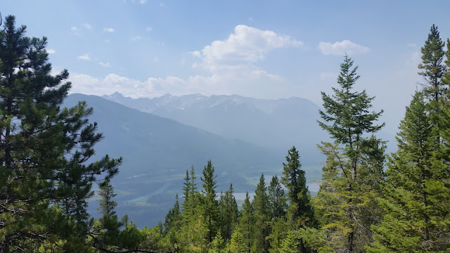
This trail is the only one we have hiked that did not have signs to clarify the route when coming to an intersection. At one point, we came to a knoll with trails going off in four directions. We did short checks of three before taking the counter intuitive one that made almost a u-turn back away from the way we had come and headed down as well. It was marked with a piece of plastic orange tape tied to a tree. Fortunately, that turned out to be the correct way and we came upon an opening with limited views of Banff and the Bow Valley - still somewhat obscured by smoke from forest fires in British Columbia.

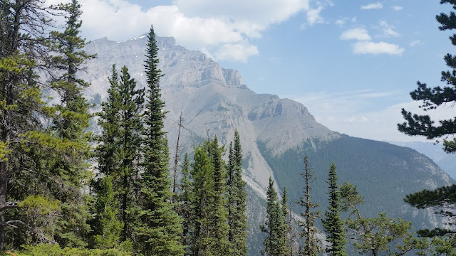
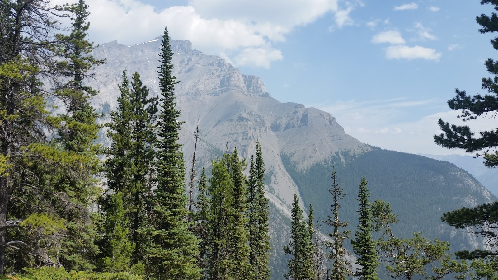
The trail continued onward and upward for another quarter mile before we finally came to the summit - but again, no sign, just majestic mountain views.

After resting for a few minutes we spent the next hour hiking down. And as luck would have it, as we were driving down from the parking lot, we came across what I believe are juvenile big horn sheep on the side of the road. They were not intimidated nor bothered by pedestrians nor those of us driving by in our car.


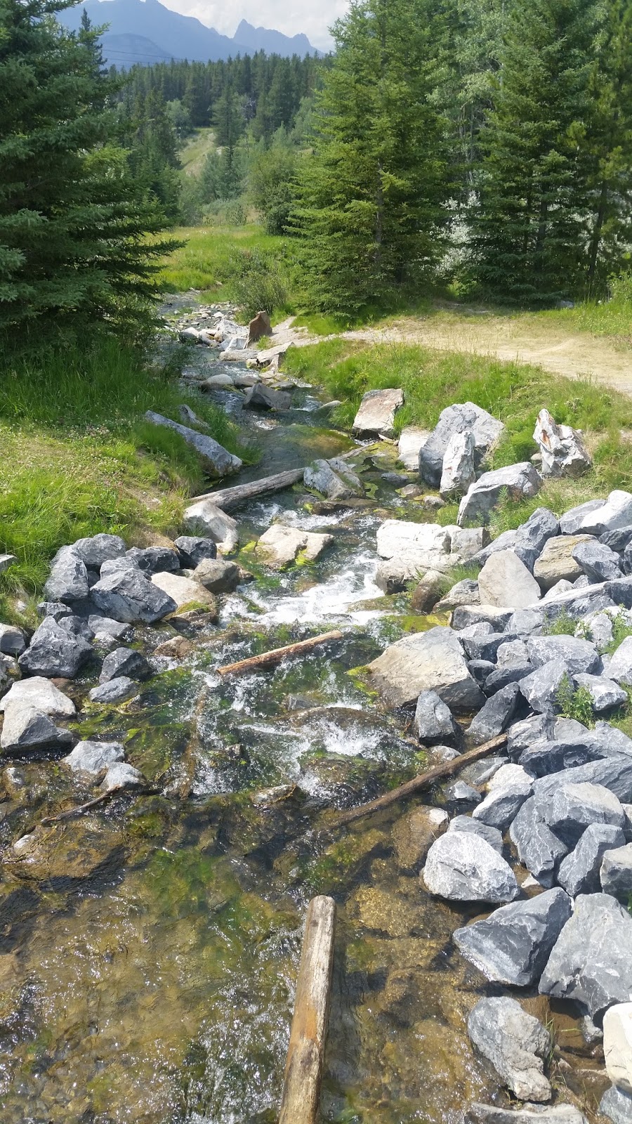
We then drove to Lake Johnson and schlepped our lunches over to the far side of the lake where we had a delightful lunch. After lunch, I took some photos of the lake and mountains, and the outflow from the lake.


We would have stayed longer and hiked around the lake, but rumbles of thunder were coming closer and there was a little bit of rain. We were not concerned about the rain, but most people there, including us, decided to leave before a thunderstorm could come. On our way out, I checked the signs - unlike other places that merely cautioned that it was berry harvesting time so look out for bears, this area had a sign indicating that at least one bear had been seen there at the lake.


We then drove to Lake Minnewanka, a place with some interesting history. This is fromWikipedia:
Dams were built in 1912 and 1941 to supply the town with hydro-electric power. The most recent dam (1941) raised the lake 30 m (98 ft) and submerged the resort village of Minnewanka Landing that had been present there since 1888. Because of the presence of the submerged village, submerged bridge pilings, and submerged dam (the one from 1912) the lake is popular among recreational scuba divers. The construction of the dam resulted in involuntary resettlement of inhabitants from the reservoir area.
Who would expect scuba diving at a mile high lake in the Canadian Rockies?

 |
| Sorry about the blurry photo |
As we had seen elsewhere, bear warnings are posted, so I had my bear spray out and attached to my belt for quick access. This is in contrast to many of the hikers and mountain bikers we have seen.

Online, I had read that this hike was 2.2 km (1.4 miles) each way and would take an hour to an hour and a half to complete. The sign at the base of the trail seemed to confirm that. Either we are getting old or those numbers are way off - it took us better than two hours and my pedometer said a bit over four miles.

The trail was through thick woods all the way, with many downed trees on and near the trail.


As elsewhere, many wildflowers are still in bloom.

There were many exposed tree roots, leading to jokes about the "root of all evil."

This trail is the only one we have hiked that did not have signs to clarify the route when coming to an intersection. At one point, we came to a knoll with trails going off in four directions. We did short checks of three before taking the counter intuitive one that made almost a u-turn back away from the way we had come and headed down as well. It was marked with a piece of plastic orange tape tied to a tree. Fortunately, that turned out to be the correct way and we came upon an opening with limited views of Banff and the Bow Valley - still somewhat obscured by smoke from forest fires in British Columbia.


The trail continued onward and upward for another quarter mile before we finally came to the summit - but again, no sign, just majestic mountain views.

After resting for a few minutes we spent the next hour hiking down. And as luck would have it, as we were driving down from the parking lot, we came across what I believe are juvenile big horn sheep on the side of the road. They were not intimidated nor bothered by pedestrians nor those of us driving by in our car.


We then drove to Lake Johnson and schlepped our lunches over to the far side of the lake where we had a delightful lunch. After lunch, I took some photos of the lake and mountains, and the outflow from the lake.


We would have stayed longer and hiked around the lake, but rumbles of thunder were coming closer and there was a little bit of rain. We were not concerned about the rain, but most people there, including us, decided to leave before a thunderstorm could come. On our way out, I checked the signs - unlike other places that merely cautioned that it was berry harvesting time so look out for bears, this area had a sign indicating that at least one bear had been seen there at the lake.


We then drove to Lake Minnewanka, a place with some interesting history. This is fromWikipedia:
Dams were built in 1912 and 1941 to supply the town with hydro-electric power. The most recent dam (1941) raised the lake 30 m (98 ft) and submerged the resort village of Minnewanka Landing that had been present there since 1888. Because of the presence of the submerged village, submerged bridge pilings, and submerged dam (the one from 1912) the lake is popular among recreational scuba divers. The construction of the dam resulted in involuntary resettlement of inhabitants from the reservoir area.
Who would expect scuba diving at a mile high lake in the Canadian Rockies?
No comments:
Post a Comment